

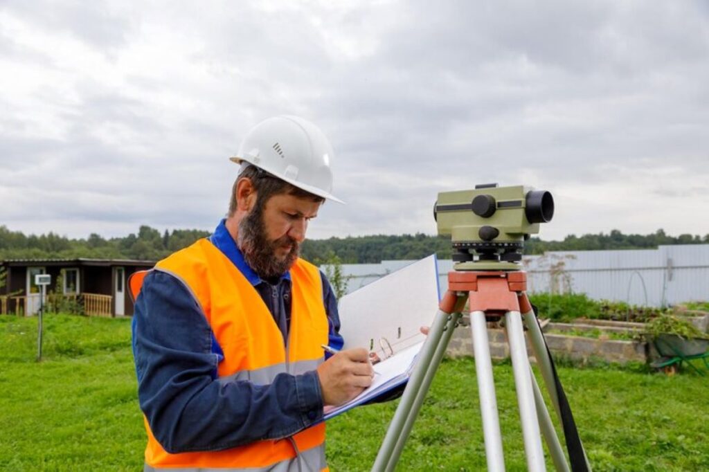
Construction surveyors are the key professionals who ensure precision and accuracy in building projects through expert measurement, analysis and documentation of land characteristics. These specialists combine technical expertise with advanced technology to establish crucial reference points, determine property boundaries, and verify construction alignments.
The role of surveying in construction goes beyond basic measurements. Construction surveyors provide essential data that guides critical decision-making throughout the project lifecycle:
- Site evaluation and planning – Detailed topographic surveys and boundary determinations
- Construction layout – Precise positioning of structural elements and utilities
- Quality control – Ongoing verification of construction accuracy
- As-built documentation – Final surveys documenting completed work
Their impact on project success is evident in every phase of construction. Through meticulous attention to detail, surveyors help prevent costly errors, ensure regulatory compliance, and maintain project timelines. Their expertise enables construction teams to work from accurate data, leading to structures that meet exact specifications while optimising resources and minimising risks.
The surveyor’s contribution creates a solid foundation for project delivery, making them indispensable partners in achieving construction excellence.
The Critical Role of Construction Surveyors in Project Accuracy
Construction surveyors are essential for ensuring accuracy in projects. They achieve this by using specialised measurement tools and techniques with expertise. Some of the advanced equipment they use includes:
- Total stations for measuring angles and distances
- GPS/GNSS receivers for precise positioning
- 3D laser scanners for detailed site mapping
- Digital levels for determining elevation
Establishing Control Points
By establishing accurate reference points and benchmarks, construction surveyors create a reliable framework for all construction activities. These control points play a crucial role in guiding various aspects of the project, including:
- Building foundation placement
- Structural alignment verification
- Underground utility installation
- Road gradient calculations
Impact on Efficiency and Cost Management
The information provided by surveyors directly affects the efficiency of construction processes and management of costs. Even a slight error of millimetres in initial measurements can lead to significant issues such as:
- Misalignments in structures
- Waste of materials
- Delays in construction timelines
- Overruns in budget
- Potential hazards to safety
Ensuring Quality through Professional Surveying Services
To mitigate these risks, professional surveying services like Wumara Group implement strict quality control measures throughout the measurement process. Their systematic approach involves:
- Regular calibration of equipment
- Verification of multiple measurements
- Detailed documentation of survey data
- Real-time protocols for detecting errors
Integration of Digital Mapping Technologies
The integration of digital mapping technologies allows surveyors to create comprehensive site models that contractors can refer to during the entire project lifecycle. These detailed maps contain crucial information about:
- Characteristics of the terrain
- Existing structures on-site
- Underground utilities present
- Boundaries of the site
Key Contributions to Construction Project Success
Construction surveyors deliver essential value throughout the project lifecycle through systematic monitoring and quality control processes. Their expertise ensures projects maintain alignment with design specifications while meeting strict industry standards.
Detailed Site Planning and Initial Assessments
Construction surveyors conduct thorough preliminary site investigations to:
- Identify potential construction challenges
- Document existing site conditions
- Analyse soil characteristics
- Map underground utilities
- Assess environmental factors
These initial assessments create the foundation for informed decision-making during project execution.
Project Monitoring Systems
Surveyors implement robust monitoring systems using:
- Regular site inspections – Scheduled checks of construction progress
- Digital documentation – Detailed records of measurements and changes
- Progress reporting – Updates on adherence to project timelines
- Deviation analysis – Identification of variances from original plans
Quality Control Measures
The quality control role of surveyors encompasses:
- Verification of construction element positioning
- Confirmation of structural alignments
- Assessment of material specifications
- Documentation of construction methodologies
- Validation of completed works
Real-Time Problem Resolution
Surveyors maintain project momentum through:
- Immediate identification of construction discrepancies
- Swift implementation of corrective measures
- Coordination with project stakeholders
- Documentation of solutions and outcomes
Collaborative Approach
The surveying team works closely with:
- Project managers
- Construction contractors
- Design engineers
- Quality assurance personnel
- Regulatory authorities
This collaborative approach ensures seamless integration of surveying data into project decision-making processes.
Technology Integration
Modern surveying practices incorporate advanced technologies:
- 3D laser scanning
- GPS positioning systems
- Digital terrain modelling
- Building Information Modelling (BIM)
- Automated monitoring systems
These tools enhance the accuracy and efficiency of project monitoring while providing comprehensive data for quality control purposes.
Resolving Discrepancies and Ensuring Compliance with Regulations
Construction surveyors are crucial in identifying measurement discrepancies and ensuring compliance with regulations. Their ability to spot differences between design plans and actual site conditions is essential for the success of any project.
Systematic Approach to Resolving Discrepancies
Here are the steps that construction surveyors follow to resolve discrepancies:
- Plan vs Reality VerificationCross-referencing design specifications with physical measurements
- Detecting variations in ground conditions or structural elements
- Documenting deviations for immediate stakeholder review
- Regulatory Compliance ChecksAssessing adherence to local building codes
- Verifying setback requirements and boundary restrictions
- Evaluating height restrictions and zoning regulations
Detailed Investigation Process for Discrepancies
When discrepancies are found, a thorough investigation process is initiated:
- Documentation of the variance
- Analysis of potential impact on project timeline
- Development of corrective solutions
- Implementation of approved adjustments
Maintaining Compliance through Proactive Measures
Construction surveyors ensure strict compliance by taking the following actions:
- Regular site inspections
- Detailed documentation of findings
- Direct communication with regulatory bodies
- Implementation of corrective measures
This proactive approach to resolving discrepancies and monitoring compliance helps avoid expensive rework, reduces project delays, and guarantees adherence to all applicable building standards and regulations.
Advanced Technology Integration in Surveying for Enhanced Accuracy and Efficiency
Modern construction surveying has undergone a technological revolution, embracing cutting-edge tools that dramatically enhance precision and efficiency. 3D laser scanning technology now enables surveyors to capture millions of data points per second, creating highly detailed digital representations of construction sites with millimetre-level accuracy.
Transformative Impact of Drone Technology on Aerial Surveying
Drone technology has transformed aerial surveying capabilities:
- Rapid collection of topographical data
- Creation of accurate orthomosaic maps
- Real-time site monitoring and progress tracking
- Access to hard-to-reach or hazardous areas
Benefits of Integrating Building Information Modelling (BIM) with Surveying Data
The integration of Building Information Modelling (BIM) with surveying data allows for:
- Virtual construction planning
- Clash detection before physical construction
- Enhanced collaboration between project stakeholders
- Real-time updates and modifications
Unprecedented Accuracy in Site Measurements with GPS and Robotic Total Stations
GPS and robotic total stations provide unprecedented accuracy in site measurements and layout work. These advanced instruments automatically track and adjust for changes, reducing human error and increasing productivity.
Instant Sharing of Survey Information through Digital Data Collection and Cloud-Based Platforms
Digital data collection and cloud-based platforms enable instant sharing of survey information across project teams. This immediate access to accurate data supports:
- Quick decision-making processes
- Remote project monitoring
- Efficient quality control measures
- Precise documentation of site conditions
The adoption of these technologies has revolutionised traditional surveying methods, delivering enhanced accuracy, improved safety, and significant time savings across construction projects.
Resource Management, Risk Mitigation, and Promoting Collaboration Among Stakeholders in Construction Projects
Construction surveyors play a crucial role in optimising resource allocation and risk management through systematic project monitoring and detailed site planning. Their expertise in creating comprehensive site plans enables early detection of potential bottlenecks, allowing for proactive resource management strategies.
Resource Optimisation Through Early Detection
Construction surveyors contribute to resource optimisation by identifying and addressing potential issues before they impact project timelines. Their detailed site analysis helps in:
- Identifying spatial constraints affecting material storage
- Analysing site access points for efficient equipment movement
- Assessing workspace requirements for different trade activities
- Mapping utility locations to prevent work disruptions
Risk Management and Safety Protocols
Construction surveyors also play a vital role in ensuring workplace safety through their thorough understanding of site conditions. They contribute to risk management by:
- Mapping hazardous areas to alert workers and contractors
- Documenting underground services to avoid accidental damage during excavation
- Assessing ground conditions to identify potential stability concerns
- Regularly monitoring site conditions to detect any changes that may pose risks
The integration of detailed site planning with initial assessments creates a robust framework for risk identification. This systematic approach enables project teams to implement preventive measures before issues escalate into significant problems.
Stakeholder Communication and Collaboration
Effective communication among stakeholders is essential for successful project execution. Construction surveyors act as intermediaries between various parties involved in the project, including:
- Project managers
- Site engineers
- Construction contractors
- Design teams
- Regulatory authorities
Their ability to translate complex technical data into accessible information facilitates informed decision-making across all project levels. Through detailed documentation and regular updates, surveyors ensure all stakeholders maintain a clear understanding of:
- Current project status
- Required modifications
- Potential challenges
- Compliance requirements
- Progress milestones
The establishment of clear communication channels through surveying documentation helps prevent misunderstandings and reduces the likelihood of costly rework. Regular project monitoring updates enable stakeholders to make timely decisions based on accurate, current site information.
This collaborative approach to project management, supported by precise surveying data, creates an environment where potential issues can be identified and resolved efficiently, maintaining project momentum and ensuring quality control standards are consistently met.
Types of Survey Stakes Used in Construction Projects and Their Importance for Compliance with Design Specifications
Survey stakes serve as physical markers that translate complex design specifications into tangible reference points on construction sites. These critical markers guide construction teams and ensure precise implementation of project plans.
Common Types of Survey Stakes:
1. Offset Stakes
- Placed at measured distances from actual construction points
- Display cut/fill information and distances
- Protect reference points from construction activity
2. Grade Stakes
- Mark finished elevations for surfaces
- Essential for proper drainage and foundation work
- Include height references for concrete pours
3. Slope Stakes
- Define transitions between different elevations
- Mark boundaries of cut-and-fill zones
- Critical for road construction and earthwork
4. Property Line Stakes
- Establish legal boundaries
- Guide fence installation and setbacks
- Prevent encroachment issues
Stake Interpretation and Usage:
Construction professionals rely on specific marking conventions to interpret stake information:
- Numerical Markings
- Station numbers
- Elevation data
- Offset distances
- Colour Coding
- Red: critical points
- Blue: water utilities
- Yellow: electrical lines
- White: proposed excavation
Quality Control Through Staking:
Proper stake placement enables:
- Verification of design implementation
- Detection of potential conflicts
- Documentation of as-built conditions
- Coordination between different trade contractors
Stakes must withstand site conditions while maintaining accuracy. Professional surveyors employ durable materials and protective measures to ensure stake integrity throughout the construction process. Regular stake checks and maintenance preserve the accuracy of these crucial reference points.
The strategic placement of survey stakes creates a physical blueprint that transforms theoretical designs into actual structures. This system of markers guides construction teams through each phase while maintaining compliance with project specifications and regulatory requirements.
In addition, stake placement must be done considering the overall project plan to ensure all aspects are covered effectively, while using the right materials which can withstand various environmental factors during the construction process.
Professional Qualifications, Industry Expertise, and Continuous Evolution of Surveying Practices
Professional licensing is a crucial requirement for construction surveyors, ensuring high standards of expertise and accountability in the field. Licensed surveyors must obtain specific qualifications, including a Professional Surveyor and Mapper (PSM) certification, demonstrating mastery of essential technical skills and knowledge.
The path to becoming a licensed surveyor includes:
- Completion of accredited degree programmes in surveying or related fields
- Extensive practical experience under senior licensed professionals
- Passing rigorous licensing examinations
- Regular professional development and skill updates
- Maintaining compliance with industry regulations
Licensed surveyors lead multidisciplinary teams across various sectors:
Construction Industry
- Managing complex infrastructure projects
- Coordinating with architects and engineers
- Supervising junior surveyors and technical staff
Infrastructure Development
- Overseeing major transportation projects
- Directing utility mapping operations
- Implementing quality control measures
Property Development
- Conducting boundary surveys
- Performing title investigations
- Preparing legal documentation
The surveying profession continues to evolve with technological advancements. Modern licensed surveyors must stay current with:
- 3D laser scanning technologies
- Geographic Information Systems (GIS)
- Building Information Modelling (BIM)
- Drone-based surveying methods
- Advanced data processing software
Professional bodies and industry associations play a vital role in maintaining standards through:
- Regular audits of professional practice
- Mandatory continuing education requirements
- Updates to professional guidelines
- Industry networking opportunities
- Research and development initiatives
Licensed surveyors must demonstrate expertise in risk management, project coordination, and technical innovation. Their leadership roles extend beyond traditional surveying tasks to include strategic planning, resource allocation, and stakeholder management across diverse construction projects.
Case Study Highlights from Wumara Group’s Services Supporting Successful Projects
Wumara Group’s extensive portfolio showcases the direct impact of professional surveying services on project success across NSW and QLD markets. The company’s integrated approach to site investigation management has delivered measurable results for diverse clients.
Telecommunications Infrastructure Projects
CI International Partnership
- Comprehensive site surveys for network infrastructure expansion
- Detailed underground utility mapping preventing service disruptions
- Precise equipment placement recommendations optimising signal coverage
- Cost savings through accurate pre-construction planning
City of Sydney Council Collaboration
- High-precision surveys for urban telecommunications upgrades
- Integration of existing infrastructure data with new development plans
- Critical subsurface utility identification
- Risk mitigation strategies for heritage-sensitive areas
Key Project Outcomes
Time Efficiency
- 25% reduction in project timeline through early issue identification
- Rapid deployment of survey teams for urgent assessments
- Streamlined approval processes with accurate documentation
Cost Management
- Minimised rework through precise initial measurements
- Reduced contingency costs with detailed site understanding
- Optimised resource allocation based on survey data
Quality Assurance
- Implementation of rigorous quality control protocols
- Regular calibration of surveying equipment
- Detailed documentation meeting regulatory requirements
The success of these projects demonstrates Wumara Group’s capability in delivering precise surveying solutions. Their work with CI International resulted in zero utility strikes during construction, while the City of Sydney Council project achieved all compliance requirements within the initial timeline. These outcomes highlight the value of professional surveying services in complex infrastructure developments.

Sustainable Practices Incorporated by Construction Surveyors for Environmental Responsibility
Construction surveyors play a vital role in promoting environmental sustainability through precise measurement and planning practices. Their expertise helps minimise ecological impact while maintaining project efficiency.
Digital Documentation and Paperless Solutions
Modern surveying techniques embrace digital documentation, reducing paper waste and storage requirements. Advanced software solutions enable:
- Real-time data sharing across project teams
- Cloud-based storage of survey records
- Digital markup and annotation capabilities
- Electronic submission of reports and documentation
Optimised Resource Management
Accurate surveying data enables precise material calculations, leading to:
- Reduced construction waste through exact quantity estimates
- Minimised excess ordering of raw materials
- Efficient use of available space and resources
- Lower transportation costs and associated carbon emissions
Environmental Impact Assessment
Construction surveyors integrate environmental considerations into their work by:
- Identifying sensitive ecological areas
- Mapping drainage patterns and water bodies
- Assessing potential impacts on local flora and fauna
- Recommending mitigation strategies for environmental protection
Sustainable Site Planning
Through detailed topographical analysis, surveyors help optimise:
- Solar orientation for energy efficiency
- Natural drainage systems
- Preservation of existing vegetation
- Erosion control measures
Technology Integration for Green Practices
Modern surveying equipment and methods support sustainability through:
- Drone Technology: Reducing the need for vehicle access in sensitive areas
- 3D Scanning: Creating accurate digital models without physical disruption
- GPS Systems: Enabling precise work with minimal site disturbance
- BIM Integration: Supporting sustainable design decisions
The implementation of these sustainable practices helps construction projects achieve environmental certifications while maintaining cost-effectiveness. Surveyors’ commitment to environmental responsibility extends beyond individual projects to influence industry-wide sustainability standards.
Conclusion
Construction surveyors are essential for successful project delivery. Their skills in accurate measurements, use of advanced technology, and quality control ensure that construction projects meet the highest standards.
Surveyors contribute to projects in various ways:
- Project Excellence: Through detailed site mapping, continuous monitoring, and strict quality control measures
- Risk Management: By spotting potential problems early and putting preventive solutions in place
- Resource Optimisation: With precise planning and effective allocation strategies
- Stakeholder Collaboration: Establishing clear communication channels between all project parties
The ongoing growth and success of the construction industry rely heavily on the knowledge of professional surveyors. They play a crucial role in promoting sustainable practices, managing resources, and ensuring compliance with regulations, making them essential partners in contemporary construction projects.
The future of construction excellence depends on the continued partnership with skilled surveyors who bring precision, innovation, and reliability to every project phase.
Related : Utility Locating Services and Survey Company Collaboration