
The integration of utility locating services and survey company collaboration represents a critical partnership in modern construction and infrastructure development. This specialized combination of expertise safeguards projects from costly delays, safety hazards, and potential damage to existing underground infrastructure.
Utility locating services employ advanced technologies to identify and map underground assets, including:
- Water and sewage lines
- Electrical cables
- Gas pipelines
- Telecommunications infrastructure
- Fiber optic networks
Survey companies complement these services by providing precise spatial data and comprehensive mapping solutions. The synergy between these two disciplines creates an essential foundation for successful project execution.
Accurate underground utility mapping stands as a cornerstone of construction project safety and efficiency. A single utility strike can result in:
- Project delays
- Substantial repair costs
- Safety risks to workers
- Service disruptions to communities
- Legal complications
This collaborative approach ensures project stakeholders receive detailed, reliable information about subsurface infrastructure, enabling informed decision-making throughout the project lifecycle.
Understanding Utility Locating Services
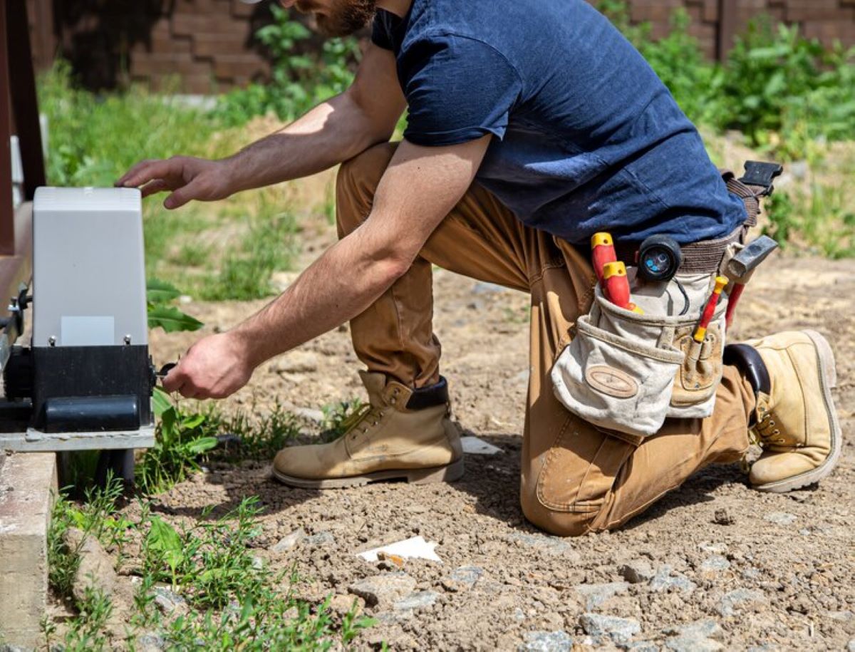
Utility locating services play a vital role in identifying and mapping underground infrastructure, including water pipes, electrical cables, gas lines, and telecommunications networks. These specialised services employ advanced detection methods to create accurate subsurface maps, protecting valuable assets and ensuring worker safety during construction activities.
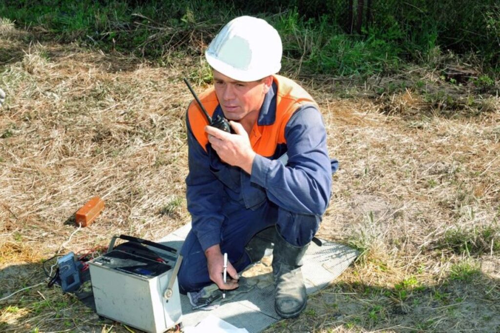
Advanced Detection Technologies
Modern utility locating relies on sophisticated equipment:
- Ground Penetrating Radar (GPR) – Uses electromagnetic waves to detect utilities up to several metres deep, effective for both metallic and non-metallic objects
- Electromagnetic (EM) Locators – Trace metallic utilities by detecting electromagnetic fields
- Acoustic Detection Systems – Identify water pipes and leaks through sound wave analysis
- Radio Detection Tools – Locate specific utility frequencies for precise mapping
Field Marking Process
The utility location process follows strict protocols:
- Site assessment and safety checks
- Equipment calibration
- Systematic scanning of designated areas
- Marking detected utilities with colour-coded paint or flags
- Digital documentation of findings
Accuracy rates typically range from 98-99% when multiple detection methods are combined.
Digital Mapping Solutions
Utility locating companies provide various digital mapping formats:
- CAD drawings
- GIS data layers
- 3D subsurface models
- PDF reports with detailed utility information
- Real-time mobile mapping updates
Additional Specialist Services
Professional utility locating firms offer complementary services:
- Leak Detection Surveys – Identify water and gas leaks
- CCTV Pipeline Inspection – Internal pipe condition assessment
- Vacuum Excavation – Non-destructive digging for utility verification
- Asset Management – Long-term infrastructure monitoring
- Emergency Response – 24/7 service for urgent locating needs
The integration of these technologies and services creates comprehensive subsurface utility maps, essential for informed decision-making in construction and infrastructure projects.
The Role of Survey Companies in Collaborating with Utility Locators
Survey companies are crucial partners in the utility locating process. They take raw field data and turn it into useful information for construction and development projects. These professional surveyors have the technical skills to manage spatial data and use advanced mapping technologies, which helps improve the accuracy of utility documentation.
Integration of Survey Data with Utility Information
Survey companies combine various sources of data to create detailed site documentation:
- Precise Positioning Systems: Using GPS and total station measurements to find exact locations of utilities
- Digital Terrain Models: Combining surface features with underground utilities
- As-Built Documentation: Recording the positions of existing infrastructure
- Quality Assurance: Checking and verifying utility locator markings and depth measurements
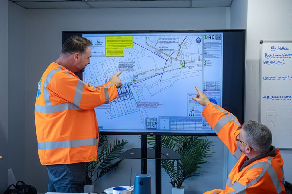
Digital Mapping Applications
When surveyors work together with utility locators, they produce valuable outputs for project stakeholders:
- CAD drawings that show detailed layouts of utilities
- 3D BIM models that include subsurface infrastructure
- GIS databases for managing assets
- Digital elevation models that display depths of utilities
- Clash detection analysis for planning construction activities
Data Conversion and Standardisation
Professional surveyors convert utility data collected from the field into standardised formats:
- Engineering Design: Changing the data into industry-standard CAD formats
- Construction Planning: Creating detailed packages of work
- Asset Management: Developing databases compatible with GIS systems
- Regulatory Compliance: Preparing documentation that meets requirements set by local authorities
Documentation Benefits
The collaboration between surveyors and utility locators leads to comprehensive geospatial documentation, which offers several benefits:
- Reduced risk of damaging utilities during excavation work
- Improved efficiency in planning projects
- Better communication between different parties involved
- Accurate records for future infrastructure projects
- Legal protection through detailed documentation
The partnership between survey companies and utility locators creates a strong system for managing underground infrastructure data. This collaboration supports safe and efficient execution of projects by providing accurate spatial documentation and professional data management.
Advantages of Collaboration Between Utility Locating Services and Survey Companies
The partnership between utility locating services and survey companies brings significant benefits to construction and infrastructure projects. This collaborative approach transforms traditional workflows into streamlined, efficient processes with measurable advantages.
Enhanced Accuracy Through Integration
- Combined expertise from both disciplines ensures precise utility mapping
- Cross-verification of data between teams reduces margin of error
- Advanced technology integration provides multi-layered accuracy checks
- Detailed documentation from both services creates comprehensive records
Risk Mitigation Strategies
- Early identification of potential utility conflicts
- Precise depth and location measurements reduce strike incidents
- Real-time data sharing enables quick response to unexpected findings
- Detailed mapping helps prevent costly service interruptions
Stakeholder Communication Enhancement
- Standardised reporting formats across both services
- Clear visual representations of underground infrastructure
- Direct access to technical expertise from both fields
- Regular updates and progress reports for all project participants
Project Planning Optimisation
- Integrated infrastructure maps for better decision-making
- Streamlined scheduling of construction activities
- Reduced project delays through accurate utility information
- Cost-effective resource allocation based on comprehensive data
Facility Management Support
- Up-to-date digital records for future reference
- Detailed as-built documentation
- Simplified maintenance planning
- Asset management integration capabilities
The partnership between utility locating services and survey companies creates a robust framework for infrastructure development. This collaboration has proven particularly valuable in complex projects across NSW and QLD markets, where accurate underground utility mapping directly impacts project success rates. The combined expertise enables projects to progress with greater confidence, supported by precise data and professional insights from both specialised fields.
See Also : How Construction Surveyors Contribute to Successful Projects
Real-World Examples: Case Studies on Utility Locating Services and Survey Company Collaboration Projects
Recent collaborative projects between utility locating services and survey companies demonstrate substantial success in infrastructure development across Australia. These case studies highlight the practical benefits of integrated approaches to underground utility management.
Telecommunications Sector Excellence
A notable project with CI International and Telstra required precise utility mapping for NBN network expansion. The collaboration delivered:
- Accurate identification of existing telecommunications infrastructure
- Digital mapping integration with survey data
- Zero utility strikes during construction
- 30% reduction in project timeline
City of Sydney Council Infrastructure Update
The City of Sydney Council’s urban renewal project showcased effective partnership between utility locators and surveyors:
- Comprehensive mapping of heritage infrastructure
- Integration of multiple utility systems
- Real-time data sharing between stakeholders
- Successful preservation of historical utilities
School Infrastructure NSW Development
A state government project with School Infrastructure NSW (SINSW) demonstrated the value of collaborative utility management:
“The project achieved 100% accuracy in utility detection and mapping, enabling safe construction of new educational facilities while maintaining existing infrastructure integrity.”
The project results included:
- Complete documentation of underground utilities across multiple school sites
- Creation of detailed 3D utility maps
- Implementation of safety protocols based on accurate utility data
- Successful coordination between construction teams and utility providers
These real-world examples demonstrate how professional collaboration between utility locating services and survey companies creates safer, more efficient project outcomes. The partnership approach has established new standards for infrastructure development across NSW and QLD markets, further emphasizing the importance of advanced mapping technologies in these successful collaborations.
Conclusion
The partnership between utility locating services and survey companies creates a powerful synergy in underground infrastructure management. This collaboration drives enhanced safety protocols, minimises project risks, and delivers precise documentation for stakeholders. A streamlined workflow emerges through:
- Integrated technological solutions
- Standardised documentation processes
- Real-time data sharing capabilities
- Comprehensive quality control measures
The demonstrated success of these collaborative efforts highlights their essential role in modern construction and infrastructure projects. This integrated approach sets new industry standards for efficiency, accuracy, and safety in underground utility management – establishing a blueprint for future infrastructure development.